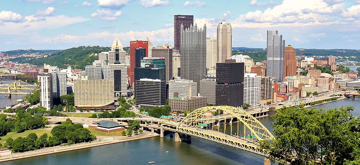
Pittsburgh's ZIP codes primarily fall within the 152xx sequence, covering a geographically complex city defined by three rivers, steep hills, and over 90 distinct neighborhoods. Whether you are navigating the local real estate market, mapping commercial delivery zones, or figuring out where the city limits end and the suburbs begin, understanding Pittsburgh's postal boundaries is essential.
Because the city's topography naturally separates communities, postal codes often serve as the most accurate way to define specific regional pockets. Here is a comprehensive breakdown of Pittsburgh ZIP codes, organized by their primary geographic sectors.
Downtown & The Golden Triangle
The central business district of Pittsburgh sits at the confluence of the Allegheny and Monongahela rivers.
-
15222: Downtown / The Cultural District / Strip District (Lower)
-
15219: Downtown / Uptown / The Bluff / Crawford-Roberts / Middle Hill
The East End
The East End is the city's largest, most populous, and most academically focused sector, housing major universities, hospitals, and historic residential avenues.
-
15213: Oakland (University of Pittsburgh) / North Oakland / West Oakland / Bellefield
-
15232: Shadyside
-
15217: Squirrel Hill / Greenfield / Point Breeze (South)
-
15206: East Liberty / Highland Park / Larimer / Garfield / Point Breeze (North)
-
15208: Homewood / Point Breeze / Regent Square (shared with suburban municipalities)
-
15224: Bloomfield / Garfield (Lower)
-
15260: Carnegie Mellon University (Dedicated campus ZIP code)
Lawrenceville & The Allegheny Riverfront
Running parallel to the Allegheny River, this corridor has transformed into one of the city's premier dining and residential hubs.
-
15201: Lower Lawrenceville / Central Lawrenceville / Upper Lawrenceville / Stanton Heights
The South Side & Mount Washington
Located south of the Monongahela River, these neighborhoods feature some of the city's most famous nightlife and its most iconic skyline views.
-
15203: South Side Flats / South Side Slopes / Arlington
-
15211: Mount Washington / Duquesne Heights
-
15210: Allentown / Knoxville / Beltzhoover / Carrick
The North Side
Encompassing the neighborhoods directly across the Allegheny River from Downtown, the North Side is home to the city's major sports stadiums and massive historic districts.
-
15212: North Shore / Allegheny Center / Central Northside (Mexican War Streets) / Troy Hill / Perry South / Spring Hill
-
15233: Manchester / Chateau
-
15214: Observatory Hill / Perry North / Summer Hill
The West End & Southwest Pittsburgh
Tucked into the valleys and hills west of the Ohio and Monongahela rivers, this area is highly residential and seamlessly borders several western suburbs.
-
15220: West End / Elliott / Banksville / Westwood
-
15204: Sheraden / Corliss / Chartiers City
-
15205: Crafton / Fairywood / Windgap (Shared with suburban municipalities)
The South Hills (City Limits)
While the "South Hills" largely refers to suburban municipalities outside city limits, several densely populated Pittsburgh neighborhoods occupy the northern edge of this region.
-
15226: Brookline / Overbrook
-
15216: Beechview / Dormont (Shared with suburban municipalities)
Navigating Pittsburgh's bridges, tunnels, and winding roads can be notoriously tricky, but mastering this numerical grid is the most reliable way to map out the Steel City.
 Share This Article on Social Media